5 things to know about Virtual Singapore

Imagine being a researcher or city planner with the power to fly through and experience a digital version of Singapore with every detail reproduced true-to-life — from street names and traffic information, to population data and environmental conditions.
It’s the SimCity game brought to life but with real-world properties.
Thanks to an ambitious project known as Virtual Singapore, scientists and urban planners can — at the touch of a button — conduct experiments and run simulations through a data-rich, 3D model of Singapore.
Here are five things you should know about Virtual Singapore and how it could impact urban planning in the Smart Nation.
-
The Nation's Data-Driven Identical Twin
-
Virtual 3D Model is Detailed and Semantically Enriched
-
Smart Nation data in real-time
-
Allowing for Different Views of the Cityscape
-
The Sky’s the Limit for Virtual Singapore
1. The Nation’s Data-Driven Identical Twin
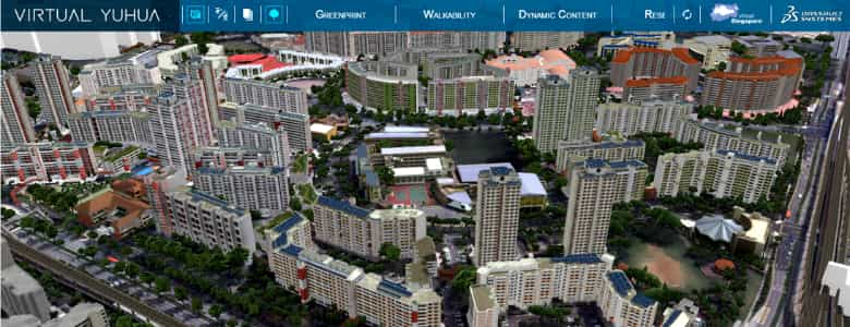
Put simply, Virtual Singapore is a 3D digital model of Singapore, built in intricate detail. Users can navigate through this virtual city and explore it like never before, with access to all kinds of information and points of view.
In addition, the model is also crammed with real-time, dynamic data (more on that later), which can be used in simulations and virtual tests of new solutions to urban planning problems.
Virtual Singapore is a collaboration between the National Research Foundation (NRF), the Singapore Land Authority (SLA), which provides topographical mapping data for the 3D model, and the Government Technology Agency of Singapore (GovTech), which provides information and communications technology expertise.
To build an easily navigable virtual city, NRF is also collaborating with French software company Dassault Systèmes, which specialises in 3D design software.
The areas of Yuhua and Teck Ghee have already been mapped and modelled. Up next: Virtual Ang Mo Kio, which will be completed over the next few months, said Mr George Loh, Director (Programmes) at NRF.
“Other areas in Singapore will be modelled from mid-2017,” Mr Loh told TechNews.
2. Virtual 3D Model is Detailed and Semantically Enriched
This means that the computer understands the real-world meaning and context of the information — when looking at a representation of a building, for example, it knows what kind of building it is, and what kind of roof, walls, doors and windows it has.
“The fact that the computer knows all this information means that more advanced simulation and analysis can be carried out,” Dr Ronnie Lee, deputy director of GovTech’s Geospatial Specialist Office, told TechNews.
With both details and semantics, researchers can use the Virtual Singapore platform to run virtual experiments.
“You could for example find all the roof surfaces for buildings of a certain height in a certain area, or find all the wall surfaces orientated at a certain bearing and calculate the amount of sunlight falling on them,” said Dr Lee. This would indicate how much energy you could expect to generate by installing solar panels on the building.
Simulations could also be used for disaster prevention; for example, modelling could be used to predict the impact of flooding, and hence guide the development of pre-emptive strategies to mitigate it.
3. Smart Nation data in real-time
Static 3D models limit the kinds of simulations users can do.
Instead, Virtual Singapore is a dynamic model, meaning that it incorporates all sorts of real-time data from the network of sensors that have already been installed across the country.
“The platform is able to connect to any real-time data,” said Dr Lee. “For example, environmental sensor data can be piped over at regular intervals to a data store. Analysis and simulations can then be carried out on this data.”
Air quality, temperature and noise data, for example, could be used to simulate urban pollution and help guide strategies to reduce it.
Other types of environmental data could also be used to simulate wind flow and urban heat island effects, which could then be used for urban planning purposes.
4. Allowing for Different Views of the Cityscape

By layering all kinds of data on top of a 3D landscape, Virtual Singapore gives city planners a holistic, all-seeing view of the city-state.
This lets them draw connections between disparate parts of the city, and explore potential far-reaching impacts of proposed changes.
For example, before urban development initiatives — such as building a new highway or sports stadium — are implemented, their impact on traffic, pollution and other factors can be simulated and assessed.
The platform is also meant to be a collaborative one, where different sectors can come together to work on complex problems facing Singapore.
When completed, likely in 2018, experts from the Government, academia and the private sector will be able to access and navigate through Virtual Singapore, while the general public will have to wait a little longer.
“The platform is targeted to be ready by 2018 for use by government agencies. Thereafter, it will be deployed to the public progressively,” said NRF’s Mr Loh.
5. The Sky’s the Limit for Virtual Singapore
With so much data underpinning it, the sky’s the limit when it comes to what Virtual Singapore could potentially do.
One application could be to identify the safest route for cyclists to use — one which bypasses heavy traffic, for example.
This is a more complicated problem than finding the shortest route, which would not necessarily be the safest.
Another possibility, which takes advantage of the detailed 3D information in the model, is drone flight path planning.
“A virtual drone flight path can be developed in the virtual world, with real-world coordinates,” said Dr Lee.
“This will allow planners to determine the best view for capture.”
And that’s not all that can be done with Virtual Singapore.
NRF’s Mr Loh added: “Public agencies will continue to identify suitable modelling and simulation applications for Virtual Singapore. Ideas from the public could also be gathered through activities such as hackathons.”
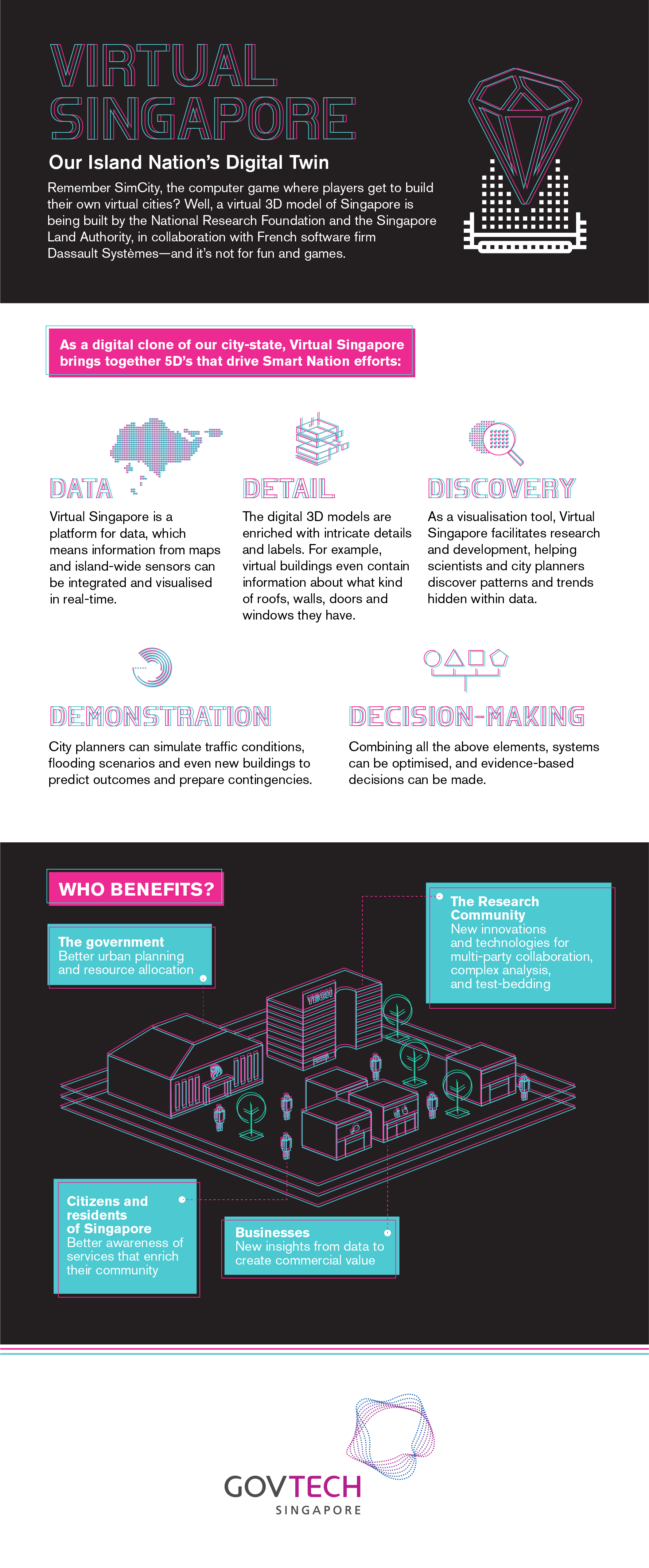
Summary of Virtual Singapore


