Navigating a post circuit breaker Singapore with data driven tech

Photo credit: Victor He on Unsplash
As Singapore restarts its economy, data-driven tech solutions will play a crucial role in helping the nation safely and successfully get back on its feet.
Since the implementation of the circuit breaker measures, Singapore has seen a decline in community COVID-19 cases. As a result, the government has recently released a roadmap detailing a three-phase approach to gradually restarting the nation’s social and economic activities.
Singapore’s transition into a “Safe Nation”, however, depends upon successfully containing any subsequent waves of COVID-19 in the community. In other words, though the circuit breaker period may be over, it’s no excuse to let our guard down. Practices that support public health, such as safe distancing, mask-wearing and even remote work, should still be maintained for the time being—and accepted as part and parcel of our new normal.
Within a short matter of months, developments like TraceTogether and SafeEntry have shown the potential of data-driven technology in helping us adjust to the changes brought about in our daily lives by COVID-19. To showcase some of these other data-driven solutions, the Government Technology Agency (GovTech) invited developers from three different projects to a webinar on 28 May 2020 to discuss how their solutions address the challenges that could arise as Singapore safely reopens.
Staying vigilant
Temperature screening stations have become a regular sight at public spots across Singapore. Though these systems can automatically take body temperatures, dedicated staff must still be deployed to analyse the temperature readings and take action if needed. Many smaller companies and organisations, however, cannot afford to delegate temperature screening due to manpower limitations. In addition, current temperature screening systems have been described as inefficient, even causing long waiting times and queues during their initial implementation.
“When DORSCON Orange was first announced, and temperature screening was implemented, building owners told us that they faced issues with manpower and screening efficiency,” said Mr Delon Leonard, an AI engineer from the video analytics team at the Data Science and Artificial Intelligence Division (DSAID) of GovTech. “To address these issues, we wanted to create a solution that could control entry across each screening station while minimising staff deployments.”
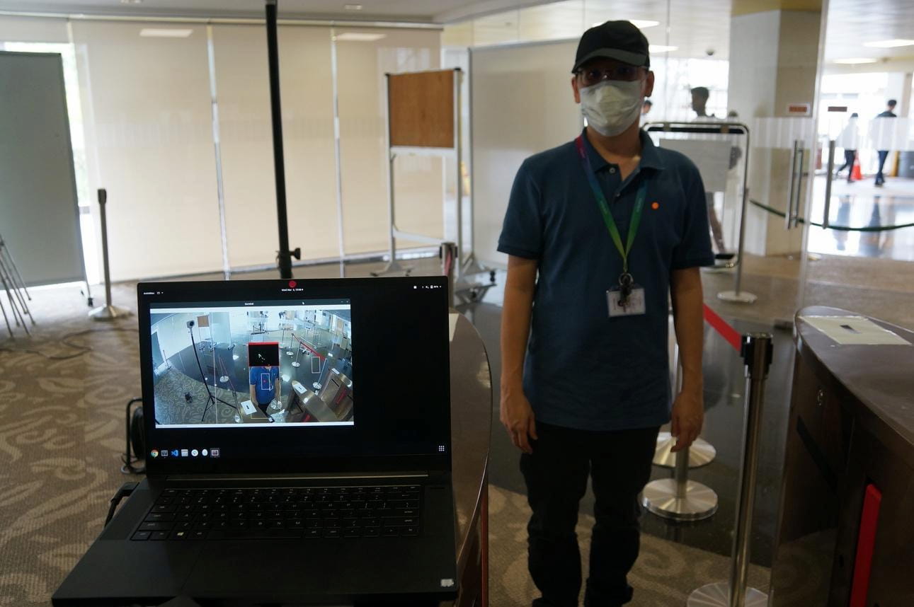
That premise soon developed into the fully automated, contactless VigilantGantry, which combines a video camera, thermal sensor, and gantry system. Through its video analytics and artificial intelligence (AI) framework, the system checks for two things: first, whether a visitor’s face is sufficiently exposed to make an accurate measurement, and second, whether the visitor has a fever. Should either of these checks fail, the gantry will restrict access.
By leveraging technology to assume the responsibilities of a human operator, VigilantGantry will help to solve their manpower crunch, said Mr Leonard. Currently, VigilantGantry is deployed at some institutes of higher learning and government agencies.

With its video analytics capabilities, VigilantGantry can detect headgear, such as caps or helmets, that could obstruct temperature screening. (Photo credit: GovTech).
A way around the crowds
Essential services have operated continuously throughout the COVID-19 period in Singapore to meet people’s needs. These include many retail malls, supermarkets, markets, banks, and post offices, among others. Measures to ensure safe distancing included guidelines on having physical separation of 1m between people for all services, and a cap of no more than 1 visitor per 16 square meters of usable space for retail malls.
While these retail operators implement the measures on the ground, information on their crowd levels is not readily available to the general public. Such information can help people make more informed choices on where or when to go to avoid crowds before they head out. This can also help relieve some pressure popular retail outlets face in crowd management.
“We collaborated with operators to bring together their crowd-level information of malls, supermarkets, markets, and post offices and made it available to the public through Space Out. This was designed to be an easy-to-use, map-based website that people can access on any digital device.” said Ms Jazreel Siew, a Systems Analyst at the Digital Planning Lab of the Urban Redevelopment Authority (URA) of Singapore.
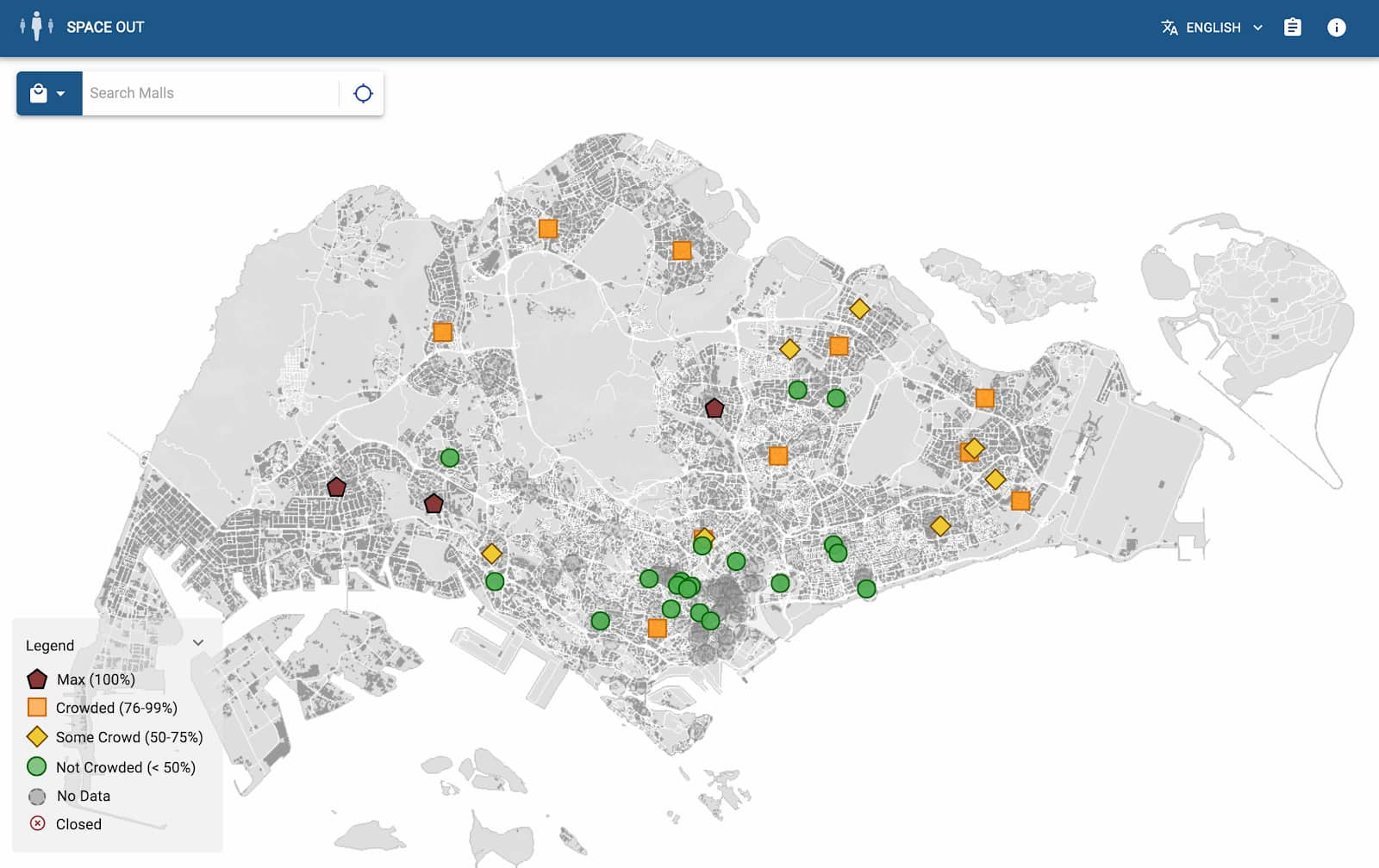
The website shows both near-real time crowd level information for malls that are able to provide it, as well as analytics on recent trends of crowd levels. People can also easily search for less crowded options nearby.
“Building Space Out was a very exciting and meaningful opportunity for me. The team designed and built the website in less than a week, and we had to develop solutions to bring together different data formats from various partners. We were able to bring our experience in developing geospatial analytics solutions for urban planning in partnership with operators to develop convenient solutions that can help everyone in Singapore stay safer during the COVID-19 period.” Ms Siew said.

A snapshot of crowd levels of participating malls across Singapore. Users can click on each symbol to check recent trends of crowd levels. (Photo credit: GovTech)
Upgrading man’s best friend
Perhaps in the near future, when you visit your neighbourhood park for a walk, you may notice dog-like robots patrolling the route, reminding you to observe safe distancing. The Smart Nation Platform Solutions (SNPS) team from GovTech had recently concluded a two-week trial of Boston Dynamics’ four-legged robot SPOT at Bishan-Ang Mo Kio Park in May for safe distancing operations.
Since before the COVID-19 pandemic, the team has been building a mobile sensor platform capable of collecting data and carrying out operations autonomously in different environments. “The whole idea was to have a robot packed full of sensors to bring in data, which is why we picked Spot® as the model for our robot,” said Mr Lim Chinn Hwa, Senior Director of the SNPS group. The SNPS team augmented Spot® with software capabilities such as remote control, 3D mapping and semi-autonomous operations, which enabled SPOT to be deployed for COVID-19-related operations.
“One of the places where we deployed Spot® was at the Changi Exhibition Centre, where it was trialled for delivering critical medical supplies from the green zone to the red zone,” said Mr Chong Jia Yi, the engineer who heads the SNPS robotics team. The reason for using Spot® in this context, he said, was to keep medical personnel safe. After all, entering the red zone entails a tedious process of dressing up in personal protective equipment (PPE). As Mr Chong recounts, there are times when tired medical personnel could inadvertently expose themselves to virus particles in the air.
Besides Changi, Spot® is also being trialled at the Bishan-Ang Mo Kio Park, where it uses deep-learning algorithms developed by the SNPS team to detect if safe distancing is observed among visitors. The team is currently working to make the augmented Spot® fully autonomous.

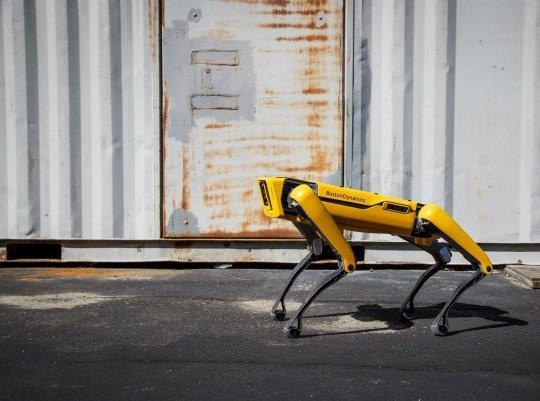
Spot®, the dog-like robot developed by Boston Dynamics. (Photo credit: Boston Dynamics)
From convenient gantry systems to robotic watchdogs, the projects showcased at the STACK-X: Meetup webinar exemplify how emerging problems can be proactively addressed by harnessing data and technology.
To find out more about ongoing projects at GovTech—including the ones mentioned above—visit the Developer Portal.


