Working Drones

They take to the sky on whirring blades, the hum of their propellers becoming a popular soundtrack of the urban environment.
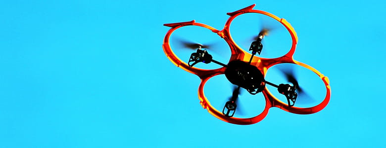
Drones — the latest generation of remote-controlled aerial tech — are becoming increasingly popular not just among recreational enthusiasts, but also among professional innovators.
Depending on the equipment they carry, drones can take on numerous exciting functions.
Just as the dragons in Game of Thrones changed the landscape of war in Westeros, the ‘Game of Drones’ looks set to revolutionise work and play.
(Editor: Please forgive the pun that is colder than the Winds of Winter.)
Here are five of the coolest real-life uses for drones we've found.
Eye in the sky
Humankind has always coveted a bird's eye view of the world.
It’s no surprise, then, that one of the most popular uses for drones is capturing images from above.
Mr Joel Chia, a photographer also known online as Idroneman, uses drones to take breathtaking aerial pictures of landscapes in Singapore and abroad.
His work received a shoutout from none other than Singapore’s Prime Minister Mr Lee Hsien Loong, who shared it in a 2016 Facebook post.
"Photography has taught me to take a step back, or with drones, to fly up high and consider the bigger picture,” says Mr Chia.
“Sometimes, we get too caught up in the here and now, and fail to consider what goes on behind the scenes, or how pieces fit into the bigger puzzle."
His wish list: Weatherproof drones in future.
"It’s quite a bummer when you have take a pass on a drone shot because it’s pouring rain or snow."
Mapping our planet
To better understand Earth’s geological history, some scientists have taken to the skies. Dr Wang Yu, a research fellow at the Nanyang Technological University’s Earth Observatory of Singapore (EOS), uses drones to carry out low-altitude aerial photo surveys.
"Modern drone technology, together with advanced photogrammetry [the use of photography for surveying], has allowed us to generate very high-resolution digital elevation models," he explains.
"We use these models to illustrate the form of the landscape, so that we can detect existing surface features that are associated with earthquakes that have occurred in the past."
Compared to satellite imaging and regular aerial photography, drones are affordable, versatile and easily accessible, Dr Wang says.
They do, however, have limitations for now — they cannot carry heavy survey instruments, and their short flight times limit the survey area on each mission, he adds.
Saving lives
In the aftermath of natural disasters, speed is critical for saving lives.
However, getting to the victims of earthquakes and forest fires can be difficult if access routes are cut off, and if rescue services face manpower shortages during large-scale crises.
Uninhibited by obstructions on the ground, drones can hover over disaster sites to provide live video feeds that help identify survivors. This method of remote monitoring mitigates the risk that rescue workers are exposed to.
They can also focus their efforts on specific locations rather than canvass a large area.
Disaster-prone countries such as Japan have started integrating drones into their disaster management operations.
In October 2016, Japan's National Fire and Disaster Management Agency invested 2.5 million yen in a drone that can be equipped with either a camera or a gas sensor for disaster reconnaissance.
There is a precedent: After the Nepal earthquake in April 2015, the UK sent search and rescue teams that were equipped with drones to help search for survivors.
Detecting defects
Lofty towers, massive bridges and expansive transport networks are the hallmarks of modern cities, and their physical stability is of paramount importance.
Regular inspections to identify flaws in structural integrity are traditionally done manually. This poses safety risks to personnel, and increases the chances of subjective reporting of defects.
Enter the BlackLion-168, a drone purpose-built by Singapore-based AeroLion Technologies (ALT) for building inspections.
"Drone technology makes inspections objective and allows coverage of hard-to-access areas such as pitched rooftops, tunnels and the underside of bridges. With image analytics, defects can be auto-detected in the images gathered by the drone's high-resolution cameras," says Mr Nicholas Yu, ALT’s business development manager.
One challenge of operating drones in Singapore: Ensuring that, in accordance with regulations, no one is standing under the drone during the inspection, says Mr Yu.
He offers a simple solution: cordon off the worksite and let the drone do its job.
Delivering items
Drones can help to overcome the reliance of traditional postal services on land routes and manpower.
But their airworthiness must be proved before they can be used for delivery.
This entails rigorous testing of their endurance limits, and ensuring the security of their navigation system. Authentication protocols are also needed to ensure that the payload is released only to the intended recipient.
In October 2015, Singapore Post (SingPost) completed a first-in-the-world trial that fulfilled all the above conditions.
SingPost also recently announced that it is partnering Airbus Helicopters to further explore the feasibility of drone delivery in urban contexts.
And with companies like Amazon pushing the envelope, we can't wait to see what else will be delivered.
So when it comes to applications for drone technology, the sky is clearly the limit — as long as the necessary safety checks and feasibility studies have been conducted, of course.


